


12 Bruceton Voting District, Carroll County, Tennessee
About
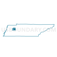
Outline

Summary
| Unique Area Identifier | 668070 |
| Name | 12 Bruceton Voting District |
| County | Carroll County |
| State | Tennessee |
| Area (square miles) | 15.18 |
| Land Area (square miles) | 15.11 |
| Water Area (square miles) | 0.07 |
| % of Land Area | 99.54 |
| % of Water Area | 0.46 |
| Latitude of the Internal Point | 36.02457830 |
| Longtitude of the Internal Point | -88.24912500 |
Maps


Graphs
Select a template below for downloading or customizing gragh for 12 Bruceton Voting District, Carroll County, Tennessee


Neighbors
Neighoring Voting District (by Name) Neighboring Voting District on the Map
- 1 Holladay School Voting District, Benton County, TN
- 11 Buena Vista Voting District, Carroll County, TN
- 13 Hollow Rock Voting District, Carroll County, TN
- 14 Vale Voting District, Carroll County, TN
- 2 Camden High School Voting District, Benton County, TN
Top 10 Neighboring County Subdivision (by Population) Neighboring County Subdivision on the Map
- District 1, Benton County, TN (2,939)
- District 4, Carroll County, TN (2,813)
- District 2, Benton County, TN (2,768)
- District 3, Carroll County, TN (2,528)
Top 10 Neighboring Place (by Population) Neighboring Place on the Map
Top 10 Neighboring Unified School District (by Population) Neighboring Unified School District on the Map
Top 10 Neighboring State Legislative District Lower Chamber (by Population) Neighboring State Legislative District Lower Chamber on the Map
- State House District 75, TN (62,143)
- State House District 79, TN (57,616)
- State House District 76, TN (55,610)